
It is a long journey, embracing the seas of three sides
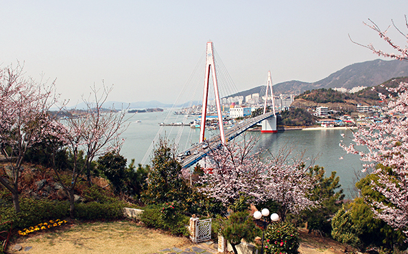
It is a ridge way, a total of 32km, which starts at Dolsandaegyo Bridge, which made the island a part of mainland, connects parks and villages, roads and mountain fortresses, and mountaintops, and reaches Hyangilam Temple, facing the southern seas of Dolsan. It is a road that makes challenges toward mountains go all in shame.
The Dolsan Mountain Main Course trailing path is a trailing path that has recently been on the spotlight along with Jeju Olle-gil and Jirisan Mountain Dulle-gil, and it is a road where you walk from the Dolsando Island’s northern end Dolsandaegyo Bridge to the southern end Hyangilam Temple. The distance is 32km, so even if you walk in a fast pace it would take about 11 hours. There are escape routes often within the course, so you can go away anytime if you don’t have much time or stamina. Heightwise, Bonghwangsan Mountain is the highest, with 460m of height, but as they are all island mountains, each mountaintop becomes the best archipelago observatory.
Section 1
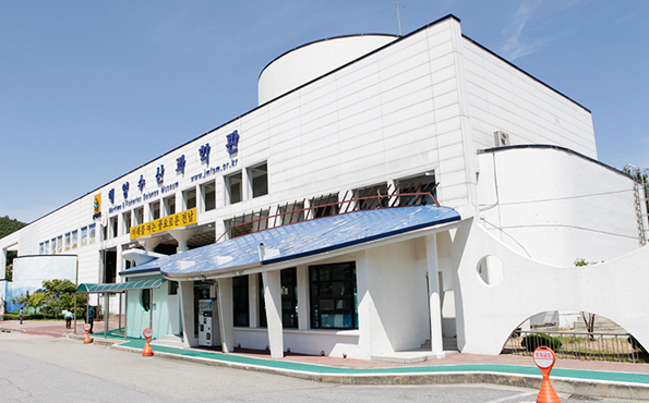
The starting point of first course among the ridge courses is Dolsandaegyo Bridge. If you go up Dolsan Park, then you will see a sculpture with the Yeosu time capsule buried in that was made in 1999, and behind that sculpture you will be standing at the first entrance to Dolsan 145 mountaintop ridge course. Continue upwards and you will see a camp, and continue on through the mountain paths, pass mountaintop 114 and Somisan Mountain, and you will arrive in Musulmok where Mongdol Beach and Marine Fisheries Museum is located in. Somisan Mountain is 210m high. It is facing Daemisan and Musulmok while being in between them, and it was named so because it is smaller than Daemisan. If you climb about 30 minutes from the nearby Pyeongsari Guljeon Village, then you can arrive at the summit of Somisan Mountain, and if you stand at the summit you can see nearby islands, such as Oechido Island, Naechido Islnad, Hyeoldo Island, and Jukdo Island. There is a washroom and an observatory, along with a beacon mound on the summit. Behind the observatory is the way down. Follow the steep rock paths and stairs for 30 minutes and you will find yourself at the entrance with the direction boards. Go to the right and pass the ‘Admiral Yi Sun-sin monument memorial’ to go down to the road. If you head left and pass by Jeolla Namdo Marine Fisheries Science Museum, it is the right side of the three-way intersection. Musulmok has the width of 200m, and is the narrowest area in Dolsando Island.

Section 2
The 2nd course, a total of 8.9km, takes about 3 hours. Head right to about 50m from Musulmok three way intersections, with Jeolla Namdo Fisheries Science Museum and Mongdol Beach, and go left, then you will find Daemisan nature exploration road, the entrance to the 2nd course. After the wooden staircase shows up, it becomes a real mountain course. Climb up uphill for 30 minutes and pass by the middle rest area, and you will find a natural cave. 2-3minutes from here you will find washing place watered by a spring, washrooms, and an observatory. Climb to the right of the observatory, and it is Woramsanseong Mountain Fortress. Come down about 10m from the fortress and head to the right path for about 2-3 minutes, and it is the summit of Daemisan Mountain, with a beacon mound. The sea seen from Daemisan Woramsanseong Mountain Fortress is not like any other. The road that crosses Musulmok and the seas that look like the sky opens up with a blue color. Just like the note on the fishery farm, it becomes a picture, and the fishing boats that leave a white path on the quiet seas are also beautiful.
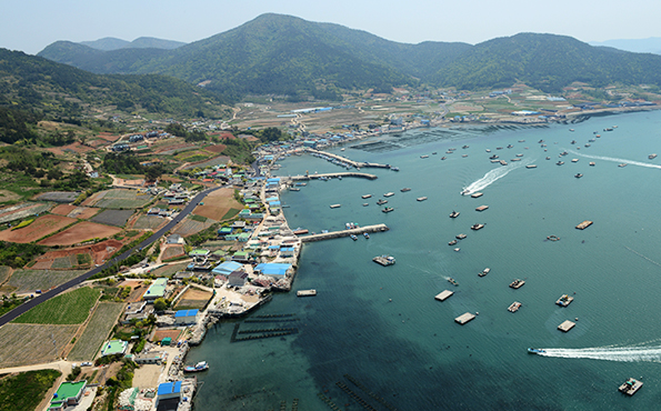
In order to go back down, return about 100m and come down to the observatory. The road continues to the ‘Woram’ direction beside the washroom. Continue about 15 minutes downward and you will see a direction board that says ‘Daemisan 1735m’ and a dolmen. Head left from here, and you will find yourself on Woramgogae road. Head right and continue on, and the path continues beside the fields. Go in for about 50m and head to the left at the intersection. Head 10 minutes and it is 183m mountaintop, with robust trees. If you pass 183 mountaintop and head on, you will see Gyedong Village. Gyedong Village is famous for unboned sliced raw fish, so there are many raw fish restaurants where you can taste it. If you head on after tasting Gyedong unboned sliced raw fish, then it is 237m mountaintop, with ruins of a castle and a cemetery. Head 15 minutes more and it is the summit of the main mountain, also with the ruins of a castle. Head to the steep path from the summit for about 10 minutes and you will see Jakgokjae. If you look downward to the sea from Jakgokjae summit, the Jukpori village, with Bangjukpo Beach, becomes visible in a sight.
Section 3
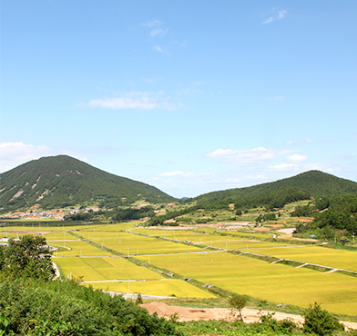
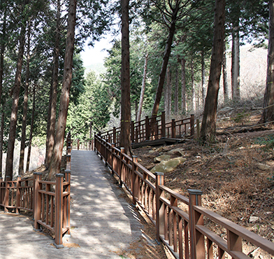
Section 3, the longest and hardest among Dolsan Mountain Main Course, starts at Jakgokjae. Pass by Jakgokjae, meaning a hill with a fortress, and head to Sujuksan Mountain. Sujuksan Mountain, with good water and abundant bamboo, because it has a spring you can often see rainbows. Pass by retinispora forest and bamboo tunnel and you will arrive at Sujuksanseong, which seemingly was made in a similar period with the nearby Bonsanseong and Gwanyeoksanseong of Galgujisan Mountain. Follow the Sujuksan ridge, pass by Dukgok and Bongyang villages, and climb over Galmibong, and it is Bonghwangsan, the highest point in Dolsan. Bonghwangsan, located in the middle of the island, is 460m and it lies over Yullim-ri, Seodeok-ri, and Jukpo-ri. It has the auspicious look, probably because it is said since from the ancient times that a phoenix lived here. Pass by 394 mountaintop and 274 mountaintop and you can take a rest at Yullimjae from the long section 3.

Section 4
The last course, section 4, is the shortest course among Dolsan Mountain Main Course, 3km. It starts at yullimjae and it can be completed within about an hour. It is mostly formed of Geumosan Mountain and Hyangilam Temple.
Geumosan Mountain is a beautiful mountain on the southern edge of Dolsanseom Island, formed of curious rocks, and Hyangilam Temple is one of the top 3 praying places, and is a hotspot of Namdo, famous for sunrise and sunset. Dolsando Island stretched long to the south, cutting across the sea. The mountain paths follow the ridge and flow between the seas. For that reason, you can see the sea whether you look left or right. From the starting point Dolsandaegyo Bridge to the arriving point Hyangilam Temple, it starts with the sea and ends with the sea. If you climb the mountain just a little you can see the sea. The small islands and silvery seas seen on top of Somisan. The highlights of the sea seen from Daemisan Woramsanseong Mountain Fortress is the road that crosses Musulmok and the seas that stretch left and right that looks like the sky. Cross Bonghwangsan Mountain and you can see many islands of Marine National Park Archipelago.
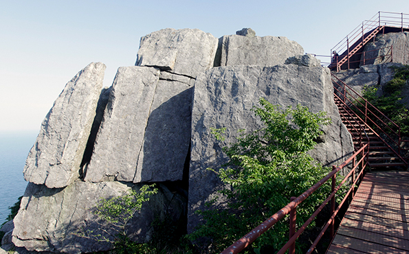
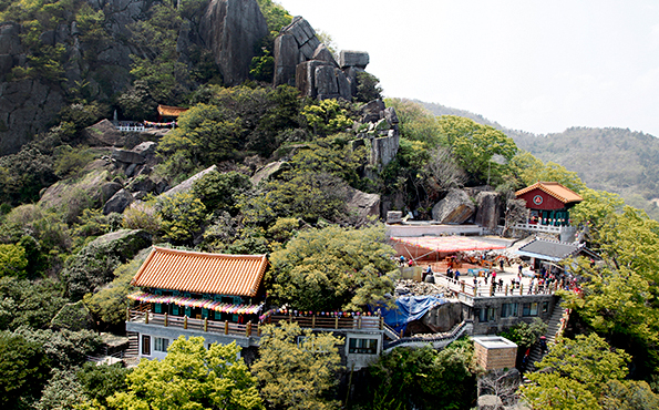
As you climb the ridge of the mountain, you can see the sun from beyond the seas. The seas seen from the mountain climbing paths and the sunrise spectacle. Continue mountain climbing and you can see sunset as well. You can see the grand spectacle of the sunset that reddens the islands as it disappears, and the beautiful night sea views as well. Go up and down over 15 times in a place near the seas. Although the altitude difference is within 400m, as you have to climb up and down over and over, it is not easy. However, it is the kind of road that is to be traveled again because of its various charms.

